Berlin Spy Tunnel Memorial
An information stele and three panels of photographs stand in a quiet meadow park on the southeastern edge of Berlin, marking where the CIA and MI6 dug a 450-metre tunnel under the sector border to tap the telephone cables of the Soviet army. It is one of the few sites on the Berlin Wall Trail whose story predates the Wall entirely.
The memorial sits in the Landschaftspark Rudow-Altglienicke, between Mozartring and Dankmarsteig, on the line the border once followed. There is nothing to see of the tunnel itself. What the site offers instead is the geography, which is the part no museum can give you: standing here you are within a few metres of the point where a joint American and British intelligence operation crossed out of West Berlin and under the Soviet sector, and where, five years later, the Berlin Wall was built directly over the top of it.
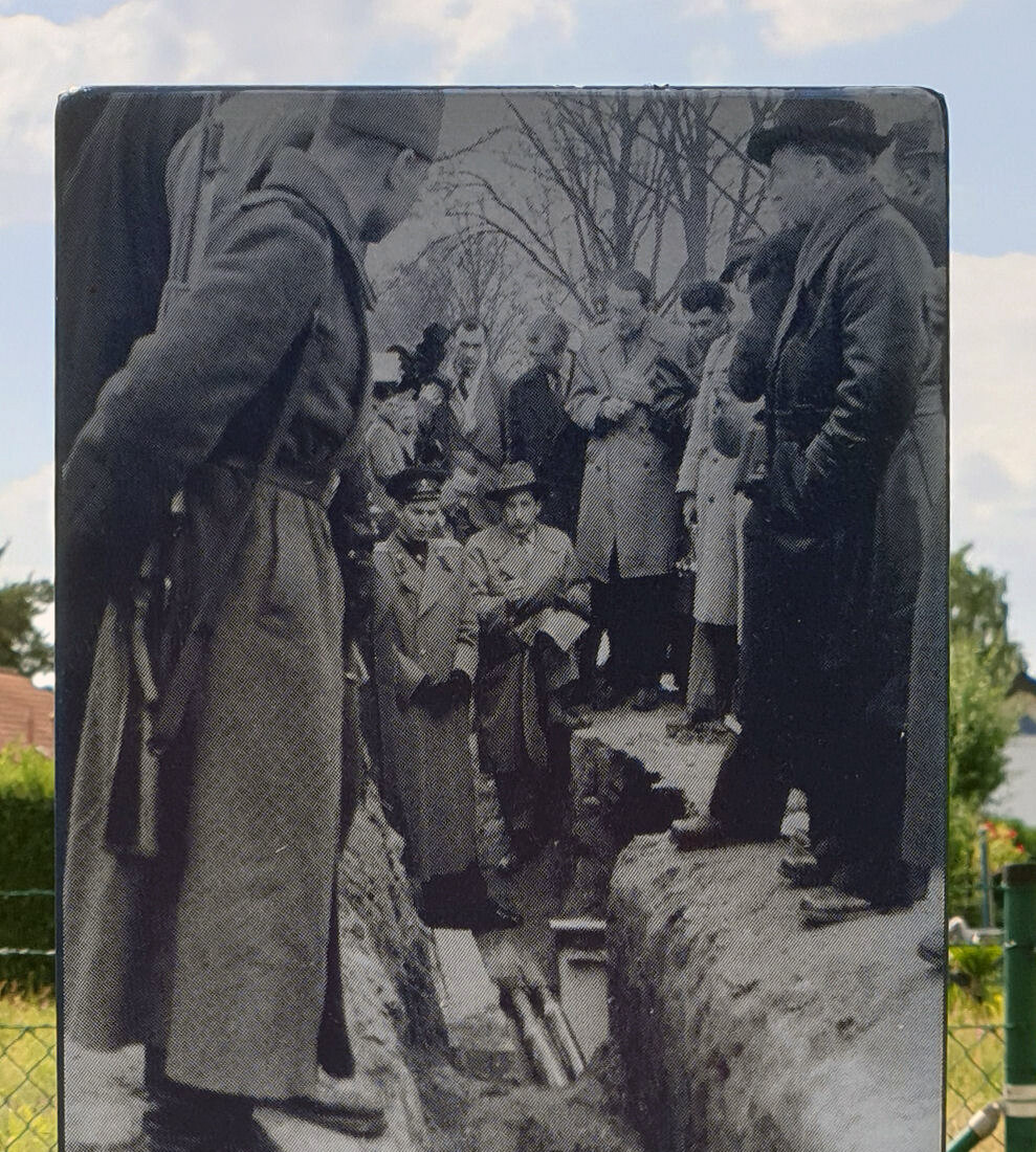
Information stele at the spy tunnel memorial on the Berlin Wall Trail in Rudow (Photo: OTFW, Berlin)
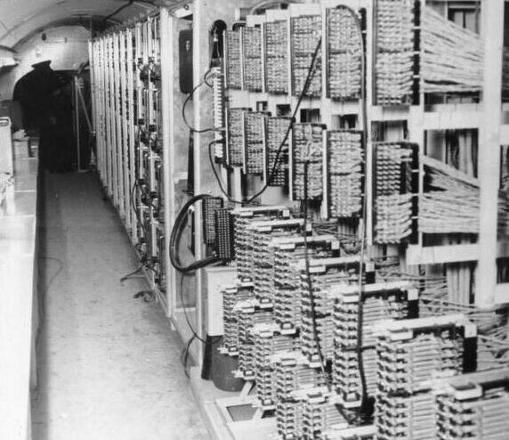
Between 1954 and 1956 the Americans built a warehouse on this side of the border, with a United States Air Force radar station on the site as cover. The warehouse had a deep basement, which served two purposes: it concealed the head of a vertical shaft, and it solved the problem of where to put three thousand tons of excavated soil in full view of East German border guards. From the bottom of that shaft a tunnel ran east at right angles to the road, past the edge of the Altglienicke village cemetery, to a tap chamber under the Schoenefelder Chaussee. Roughly 120 metres of it lay under West Berlin and about 330 metres under the East.
The Americans called the operation Gold and the British called it Stopwatch. For eleven months and eleven days it recorded the telephone and telegraph traffic of the Soviet high command at Karlshorst. It was betrayed before the first spade went into the ground by George Blake, an MI6 officer working for the KGB, and the Soviets allowed it to run rather than expose him.
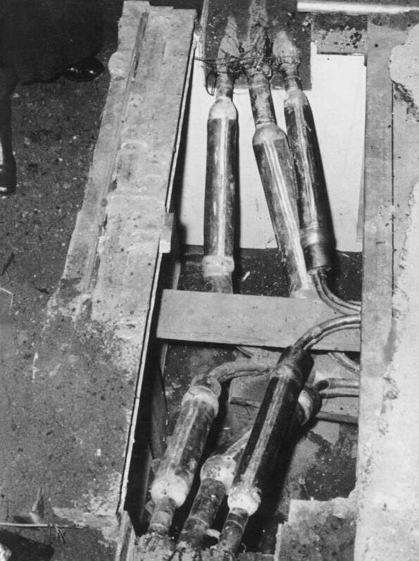
The exposed tap point on the Soviet telephone cables under Schoenefelder Chaussee, April 1956 (Photo: Bundesarchiv)
The tunnel was found on 22 April 1956, after heavy rain flooded the cable ducts and Soviet repair crews working north along the line dug straight onto the tap chamber. The Soviets protested, then opened the tunnel to visitors as a propaganda exhibit, and East Berliners queued to walk through it. The full story, including what the CIA’s own declassified history says about whether the discovery was really an accident, is in our guide to the Berlin spy tunnel and Operation Gold.
Nothing of the tunnel remains here. The Soviets removed the eastern section in the autumn of 1956, and the western stretch survived the entire Cold War only to be dug up and scrapped in 1995. Single-family houses now stand on the warehouse site and the A113 motorway cuts across the line. The park itself was laid out as compensation for that motorway, which is why a stretch of former death strip is now meadow, scrub and grazing.
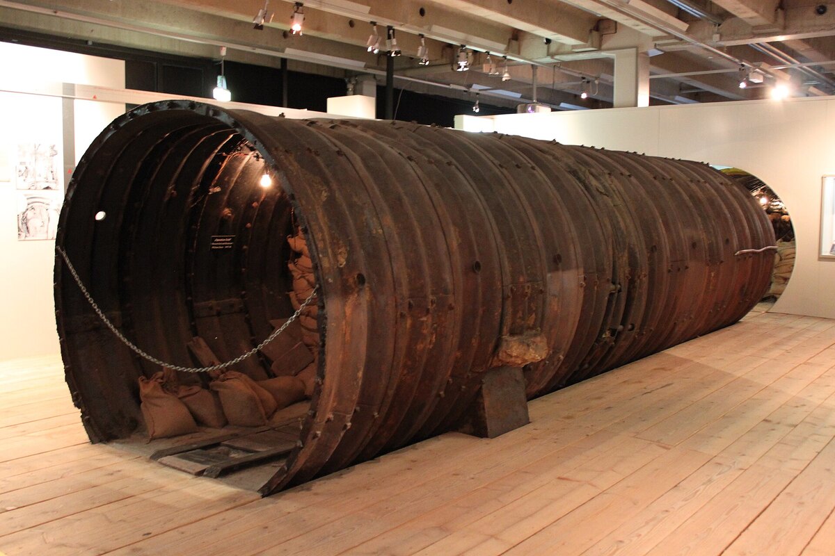
The preserved seven-metre section of the spy tunnel on display at the Allied Museum in Berlin-Dahlem (Photo: Anagoria)
To see the tunnel rather than the place where it ran, go to the Allied Museum in Berlin-Dahlem, which holds the only original segments anywhere in the world and lets visitors walk into about seven metres of it. Entry there is free.
The memorial is a long way from the centre and works best combined with its neighbours on the same trail. The Rudow Hinterland Wall, a listed 450-metre stretch of the inner wall, and the former Waltersdorfer Chaussee crossing are both a little over a kilometre away, and the three together make a short walk through a corner of the border almost no visitor reaches.
Getting here: bus 164 to Dankmarsteig, about 350 metres from the stele, or U-Bahn line U7 to Rudow and a walk or bus onward. The site is open air, free and accessible at any hour.
Show me on the mapGallery


Nearby Berlin Wall Sites
_Operation_Gold3.jpg)


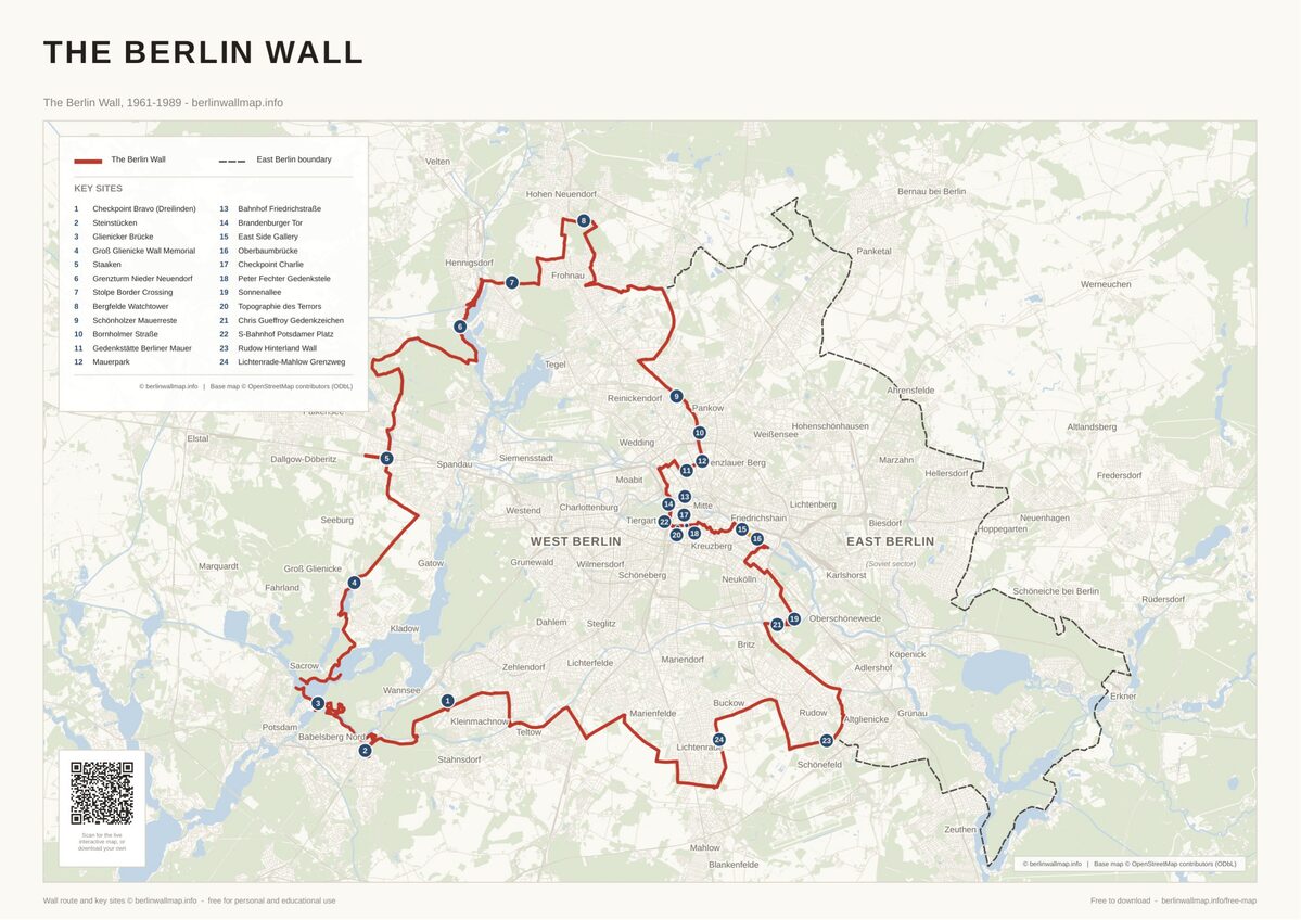
Free map downloads
Free printable PDF maps of the Berlin Wall.
Get the free maps →Explore the Timeline
Journey through Berlin Wall history from 1945 to 1990.
View Timeline →
Embed Our Map
Add a free interactive Berlin Wall map to your website or blog.
Get embed code →