How was Berlin divided after World War II?
After Germany’s surrender in May 1945, Berlin was divided into four sectors, each controlled by one of the Allied powers: the United States, Britain, France, and the Soviet Union.
The division was agreed upon at the Yalta Conference (February 1945) and the Potsdam Conference (July–August 1945). Germany as a whole was split into four occupation zones, and Berlin, located 160km inside the Soviet zone, was similarly divided.
The American sector covered the south-west of the city (Tempelhof, Kreuzberg, Neukölln, Steglitz, Zehlendorf, and Schöneberg). The British sector took the west (Tiergarten, Charlottenburg, Spandau, and Wilmersdorf). The French sector covered the north-west (Reinickendorf and Wedding). The Soviet sector, by far the largest, encompassed the entire eastern half of the city, including the historic centre with Unter den Linden, Alexanderplatz, and the Brandenburg Gate.
In 1949, the three western sectors merged to form West Berlin, aligned with the newly created Federal Republic of Germany (West Germany). The Soviet sector became East Berlin, capital of the German Democratic Republic (East Germany).
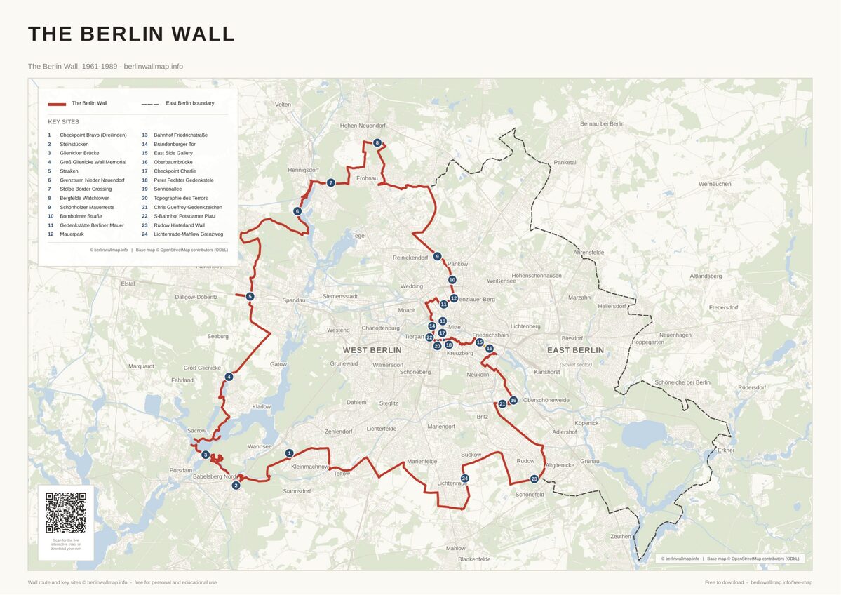
This four-sector division is the reason the Berlin Wall’s route was so irregular, it didn’t follow any natural boundary but rather the arbitrary administrative lines drawn by the occupying powers in 1945. You can see these original sector boundaries on the interactive map.
The peculiar geography also created oddities like Steinstücken, a tiny West Berlin exclave entirely surrounded by East German territory, and the bizarre situation at Alexanderplatz, where some underground platforms served East Berliners while others were sealed as ghost stations.

Free map downloads
Free printable PDF maps of the Berlin Wall.
Get the free maps →Explore the Timeline
Journey through Berlin Wall history from 1945 to 1990.
View Timeline →
Embed Our Map
Add a free interactive Berlin Wall map to your website or blog.
Get embed code →