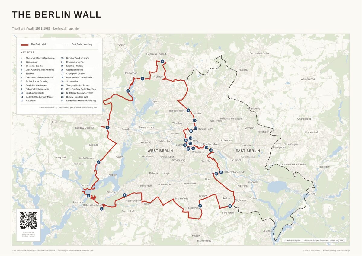
Half-Day Walk: Cold War Spies in Central Berlin
This walking tour follows the Cold War spy corridor through central Berlin. Starting from Checkpoint Charlie, the most famous border crossing, to the Tränenpalast, a station where tearful farewells played out for 28 years. All four sites lie within about two kilometres of one another, making this a genuine walk with no trains required. Allow 3–4 hours including visits.
Best for: First-time visitors, spy history fans, and anyone who wants a focused half day on foot. All four sites appear on our interactive map.
Stop 1: Checkpoint Charlie – the spy crossing
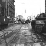
Checkpoint Charlie on Friedrichstraße was the principal Allied crossing point between the American and Soviet sectors. The area around it teemed with CIA operatives, Stasi informants, and double agents throughout the Cold War.
In October 1961 American and Soviet tanks faced each other here at point-blank range for 16 hours – the closest the Cold War came to armed conflict in Berlin. A replica guardhouse marks the spot today. Stand at the crossing, look south toward Kreuzberg and north toward Mitte, and you are looking along the exact line where two worlds met.
Walk to Stop 2: Cross to the west side of Friedrichstraße. The Mauermuseum entrance is right here at Friedrichstraße 43–45 (1 minute).
Stop 2: Mauermuseum – escape and espionage
The Mauermuseum – Haus am Checkpoint Charlie opened in 1962 while the Wall was still being reinforced. It documents escape attempts in extraordinary detail: a suitcase large enough to hide in, a one-man submarine, a hot-air balloon gondola, and the modified cars with secret compartments that smuggled people through this very checkpoint.
Alongside the escape stories, the museum covers Cold War intelligence operations and the networks that helped people cross. Allow about 60–90 minutes.
Walk to Stop 3: Head south on Friedrichstraße, turn right onto Zimmerstraße and continue west to Niederkirchnerstraße. You will walk alongside an original section of the Wall (about 10 minutes).
Stop 3: Topographie des Terrors – the machinery of repression
Topographie des Terrors sits on the site of the former Gestapo and SS headquarters. While it focuses on the Nazi terror apparatus, the exhibition connects directly to the Cold War: many of the surveillance methods the Stasi later perfected were first developed here, and the building’s ruins lay in the death strip for 28 years, inaccessible from either side.
An outdoor exhibition runs along a 200-metre stretch of original Wall – one of the longest surviving sections in the city centre. The indoor exhibition is free. Allow about 60 minutes.
Walk to Stop 4: Walk north through the government quarter, past the Brandenburg Gate area, to Friedrichstraße station (about 20 minutes through central Berlin, or take the S-Bahn one stop from Potsdamer Platz to Friedrichstraße).
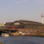
Stop 4: Tränenpalast – the Palace of Tears
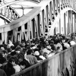
The Tränenpalast (Palace of Tears) is the glass pavilion attached to Bahnhof Friedrichstraße where East Germans said goodbye to Western visitors after their day passes expired. The nickname came from the tears shed at these enforced partings, which happened every evening for 28 years.
The free exhibition inside the original departure hall documents the border-crossing procedures, the psychology of the guards, and individual stories of separation and reunion. Original passport-control booths are preserved in place. Allow about 45 minutes.
Practical notes
- Total walking distance: approximately 3 km.
- Total time: 3–4 hours including visits.
- All four sites are free except the Mauermuseum (paid entry).
- The Topographie des Terrors outdoor exhibition is accessible 24 hours; the indoor exhibition closes at 20:00.
- This route pairs well with our Full-Day Tour: Cold War Espionage Trail, which adds Teufelsberg, the Bridge of Spies, the Stasi Museum, and Hohenschönhausen.
- For the outer Cold War sites, see our Western Spy Stations and Stasi & Surveillance half-day tours.
- Browse all locations on our places page or interactive map.
Free map downloads
Free printable PDF maps of the Berlin Wall.
Get the free maps →Explore the Timeline
Journey through Berlin Wall history from 1945 to 1990.
View Timeline →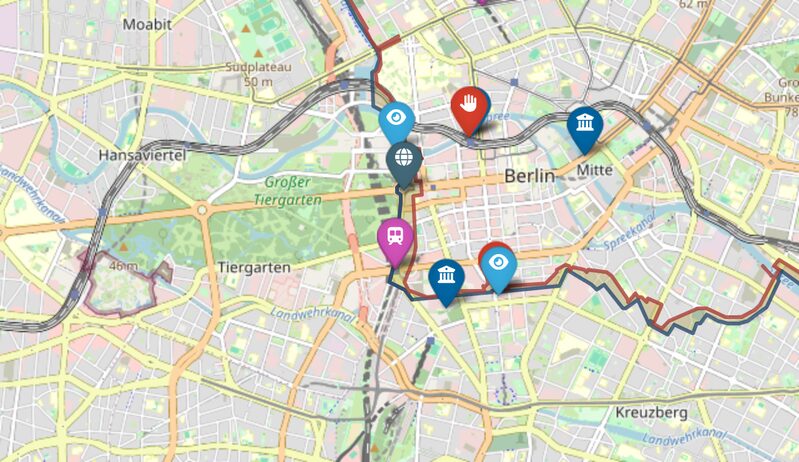
Embed Our Map
Add a free interactive Berlin Wall map to your website or blog.
Get embed code →