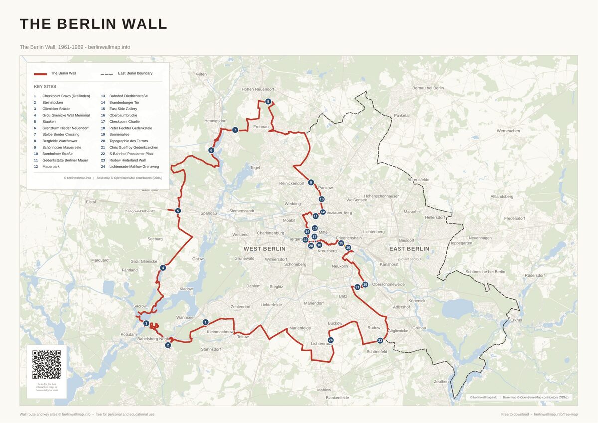
Half-Day Walk: Checkpoint Charlie to East Side Gallery
This half-day walk covers the most visited stretch of the Berlin Wall’s route through central and south-eastern Berlin. Over roughly 6 kilometres and 3 to 4 hours, you will pass through Checkpoint Charlie, several major memorials, and finish at the East Side Gallery, the longest surviving painted section of the wall. Start at Kochstraße U-Bahn station (U6) and finish at Warschauer Straße (S-Bahn and U1). This is the most popular tourist route along the wall and it gets busy, especially around Checkpoint Charlie; starting early in the morning makes a noticeable difference.
The Route
Site 1: Checkpoint Charlie
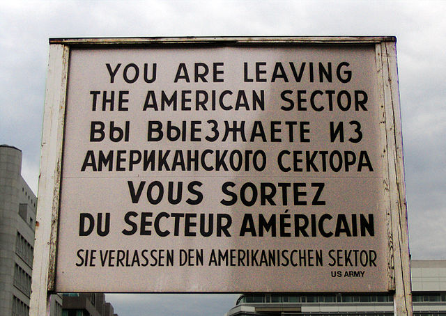
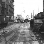
Checkpoint Charlie, at the junction of Friedrichstraße and Zimmerstraße, was the most famous Allied border crossing during the Cold War. It was the only crossing point designated for use by foreign diplomats, Allied military personnel, and non-German visitors. The original checkpoint booth was removed in 1990; what stands at the intersection today is a replica, flanked by sandbags and actors in military costume. The surrounding area is heavily commercialised, but the historical significance is real, this is where Soviet and American tanks faced each other in the tense standoff of October 1961. Take a few minutes to read the information panels on Friedrichstraße, which are more informative than the spectacle at the intersection itself.
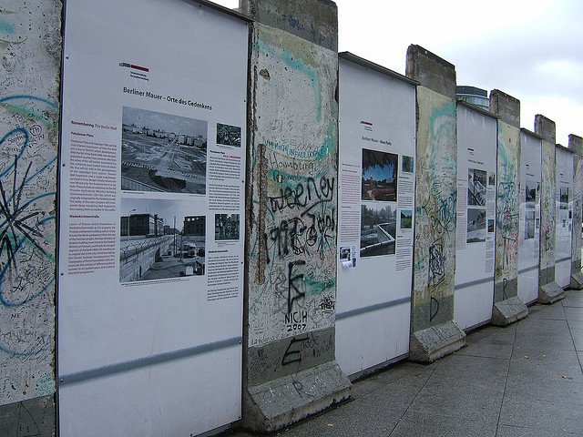
Site 2: Mauermuseum (Checkpoint Charlie Museum)
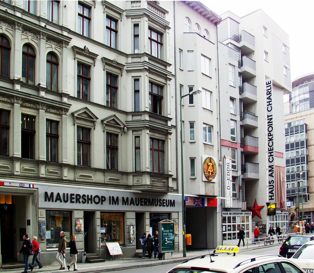
Directly adjacent to the checkpoint, the Mauermuseum has been open since 1962, it was founded while the wall was still being built. The museum’s collection focuses on escape attempts: hot-air balloons, modified cars with hidden compartments, a mini-submarine, and suitcases used to smuggle people across the border. The presentation is dense and somewhat old-fashioned, but the artefacts are extraordinary. Allow 60 to 90 minutes if you visit the museum. It is open daily and charges admission.
From the museum, walk west along Zimmerstraße.
Site 3: Peter Fechter Memorial
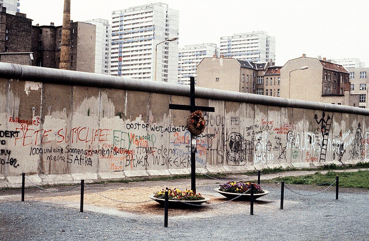
A short walk along Zimmerstraße brings you to the memorial to Peter Fechter, an 18-year-old bricklayer who was shot by East German border guards on 17 August 1962 while trying to climb the wall near this spot. He fell back into the death strip on the eastern side and lay wounded in full view of onlookers in the West. Neither East German guards nor Western authorities moved to help him. He bled to death after nearly an hour. His death provoked outrage in West Berlin and became one of the most widely reported incidents of the entire Cold War. A simple metal stele and cross mark the location.
Continue west on Zimmerstraße, then turn south onto Niederkirchnerstraße.
Site 4: Topographie des Terrors
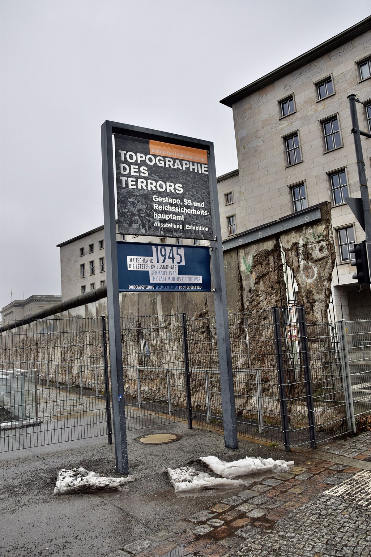
The Topographie des Terrors occupies the former site of the Gestapo and SS headquarters. The free outdoor and indoor exhibitions document the institutions of Nazi terror and their crimes. Along the site’s northern edge stands one of the longest surviving sections of the original wall, not the painted western face, but the raw, pockmarked eastern side that faced the death strip. The juxtaposition is deliberate and powerful: two of Germany’s most oppressive systems, documented on the same ground. Allow at least 45 minutes.
Site 5: Potsdamer Platz Exhibition
A short walk north brings you to Potsdamer Platz, once the busiest intersection in Europe, which the wall turned into a empty wasteland for 28 years. Today it is entirely rebuilt with modern office towers and shopping centres. A small open-air exhibition with wall segments and information panels on the north-east side of the square documents what the site looked like during the division. The contrast between the archival photographs and the glass towers around you is striking. This is a quick visit. 10 to 15 minutes, but it makes the scale of Berlin’s transformation immediately clear.
Site 6: Watchtower Erna-Berger-Straße
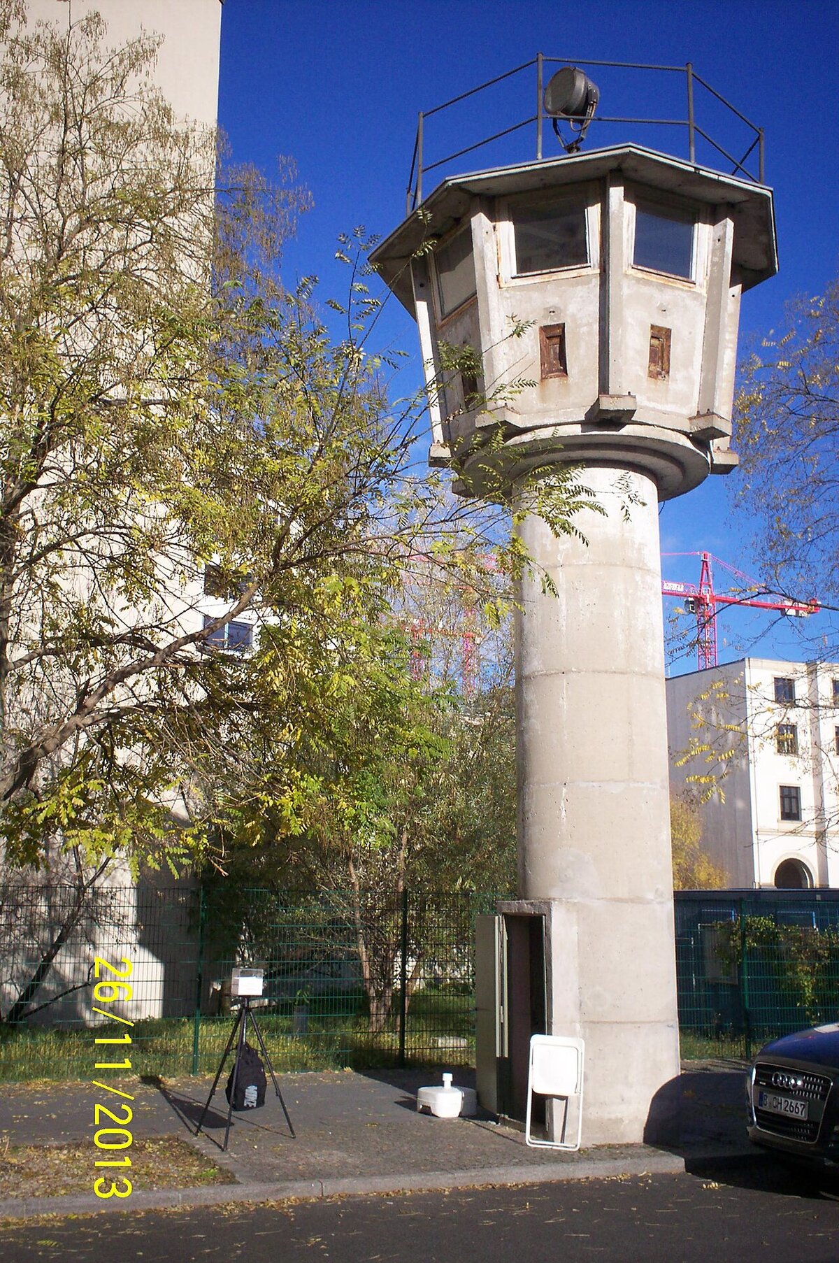
Just south of Potsdamer Platz, the watchtower on Erna-Berger-Straße is one of the very few original border watchtowers still standing in central Berlin. This type, the BT-11 round tower, gave guards a 360-degree view of the death strip. Most towers were demolished after reunification; this one survived partly by accident and is now a small museum. It provides a concrete sense of scale: standing at its base and looking up, you understand how thoroughly the border zone was surveilled.
From here, retrace your steps to Potsdamer Platz and take the S-Bahn one stop to Warschauer Straße. Alternatively, for a longer walk (approximately 3 kilometres), head east along the Landwehr Canal and the Spree toward Oberbaumbrücke.
Site 7: Oberbaumbrücke
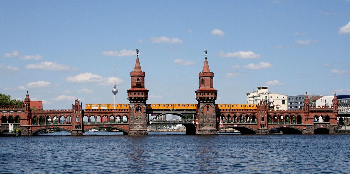
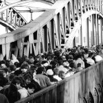
The Oberbaumbrücke is a double-deck brick bridge connecting Kreuzberg and Friedrichshain across the Spree. During the division, it served as a border crossing point for West Berlin pedestrians travelling to East Berlin. The bridge was badly damaged during the war and only partially repaired by the East German authorities, who used it as a controlled crossing. After reunification, the architect Santiago Calatrava designed a steel middle section to reconnect the two halves, a visible architectural metaphor for reunification. Today it carries the U1 line and is one of Berlin’s most photographed structures.
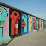
Site 8: East Side Gallery
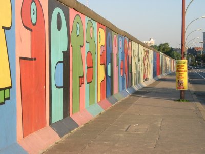
The walk ends at the East Side Gallery, a 1.3-kilometre stretch of the wall along Mühlenstraße that was painted by 118 artists from 21 countries in 1990. It is the longest surviving section of the wall and the largest open-air gallery in the world. The most famous images. Dmitri Vrubel’s “My God, Help Me to Survive This Deadly Love” (the Brezhnev-Honecker kiss) and Birgit Kinder’s Trabant crashing through the wall, are at the eastern end near Ostbahnhof. The murals were restored in 2009 and again partially in later years, though weathering and vandalism remain ongoing challenges. Walk the full length if you have time; the variety of artistic responses to the wall’s fall is remarkable.
Practical Notes
The stretch between Checkpoint Charlie and the Topographie des Terros is the busiest section of any Berlin Wall route. By mid-morning in summer, the pavement around the checkpoint replica is packed with tour groups. Starting by 9 a.m. gives you quieter conditions at the first three sites, and the East Side Gallery is generally less crowded in the early afternoon than on weekend mornings.
Food and drink are easily available along the entire route. Kreuzberg, the neighbourhood between Checkpoint Charlie and the Oberbaumbrücke, has some of Berlin’s best street food, bakeries, and cafes. The area around Warschauer Straße at the walk’s end has plenty of options as well.
Who This Walk Is Best For
This is the right route for first-time visitors who want to see the most recognisable Berlin Wall landmarks in a single half-day. It covers a wide range of experiences, from Cold War confrontation at Checkpoint Charlie to street art at the East Side Gallery, and is excellent for photography. For a deeper, less crowded experience focused on the wall’s physical structure, consider our Bernauer Straße walking route in the north. You can explore all the sites on this walk and plan your own route using our interactive map, or browse the full list of places.
Free map downloads
Free printable PDF maps of the Berlin Wall.
Get the free maps →Explore the Timeline
Journey through Berlin Wall history from 1945 to 1990.
View Timeline →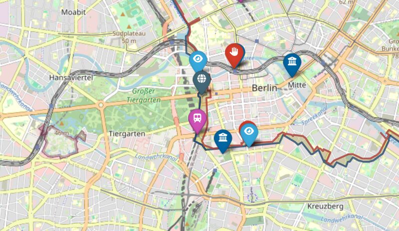
Embed Our Map
Add a free interactive Berlin Wall map to your website or blog.
Get embed code →