Flughafen Tempelhof
The airport where the Berlin Airlift (1948-1949) broke the Soviet blockade of West Berlin, with Allied planes landing every 90 seconds to supply the city. American pilot Gail Halvorsen became the “Candy Bomber” by dropping sweets for children. The Airlift Memorial (“Hungerkralle”) stands at the entrance. Now a public park, the former airfield is used by Berliners for cycling, skating, and barbecuing.
Tempelhof’s place in Cold War history was sealed during the Berlin Blockade of 1948–1949, when the Soviet Union cut off all road, rail, and canal access to West Berlin in an attempt to force the Western Allies out of the city. In response, the United States, Britain, and France launched an unprecedented airlift, flying supplies into West Berlin around the clock. At Tempelhof, planes landed every 90 seconds, delivering food, fuel, and coal to the besieged city.
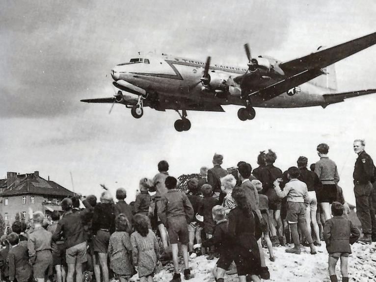
C-54 landing at Tempelhof during the Berlin Airlift, 1948 (Photo: USAF)
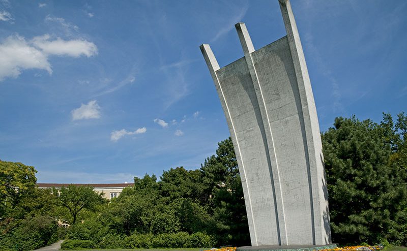
American pilot Gail Halvorsen became a beloved figure when he began dropping small bundles of sweets attached to handkerchief parachutes for the children who gathered at the airport fence. Known as the “Candy Bomber” (Rosinenbomber in German), he inspired other pilots to follow suit, and over 23 tonnes of sweets were dropped during the airlift. The Airlift Memorial, a curved concrete sculpture known as the “Hungerkralle” (Hunger Claw), stands at the airport entrance, its three prongs representing the three air corridors into West Berlin.
The airport closed to air traffic in 2008 after years of debate, and the vast airfield was opened as a public park. Tempelhofer Feld. Today Berliners use the former runways for cycling, skating, kite-flying, and barbecuing. The monumental terminal building, one of the largest structures in the world when it was built in the 1930s, is used for events and exhibitions.
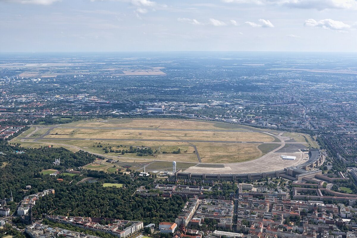
Flughafen Tempelhof aerial view (Photo: Hohum)
Gallery


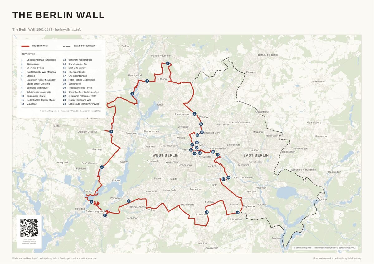
Nearby Berlin Wall Sites
.jpg)
Free map downloads
Free printable PDF maps of the Berlin Wall.
Get the free maps →Explore the Timeline
Journey through Berlin Wall history from 1945 to 1990.
View Timeline →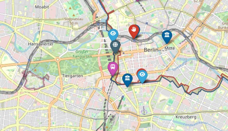
Embed Our Map
Add a free interactive Berlin Wall map to your website or blog.
Get embed code →