Free Berlin Wall Map PDF - the Full 1961-1989 Route
Download a free, printable PDF map of the Berlin Wall and see exactly where it ran. It traces the Wall's complete 1961-1989 route around West Berlin on a clear, present-day street map - marking Checkpoint Charlie, the Brandenburg Gate, the East Side Gallery and the key sites to visit. Free for personal and educational use.
What's on the map
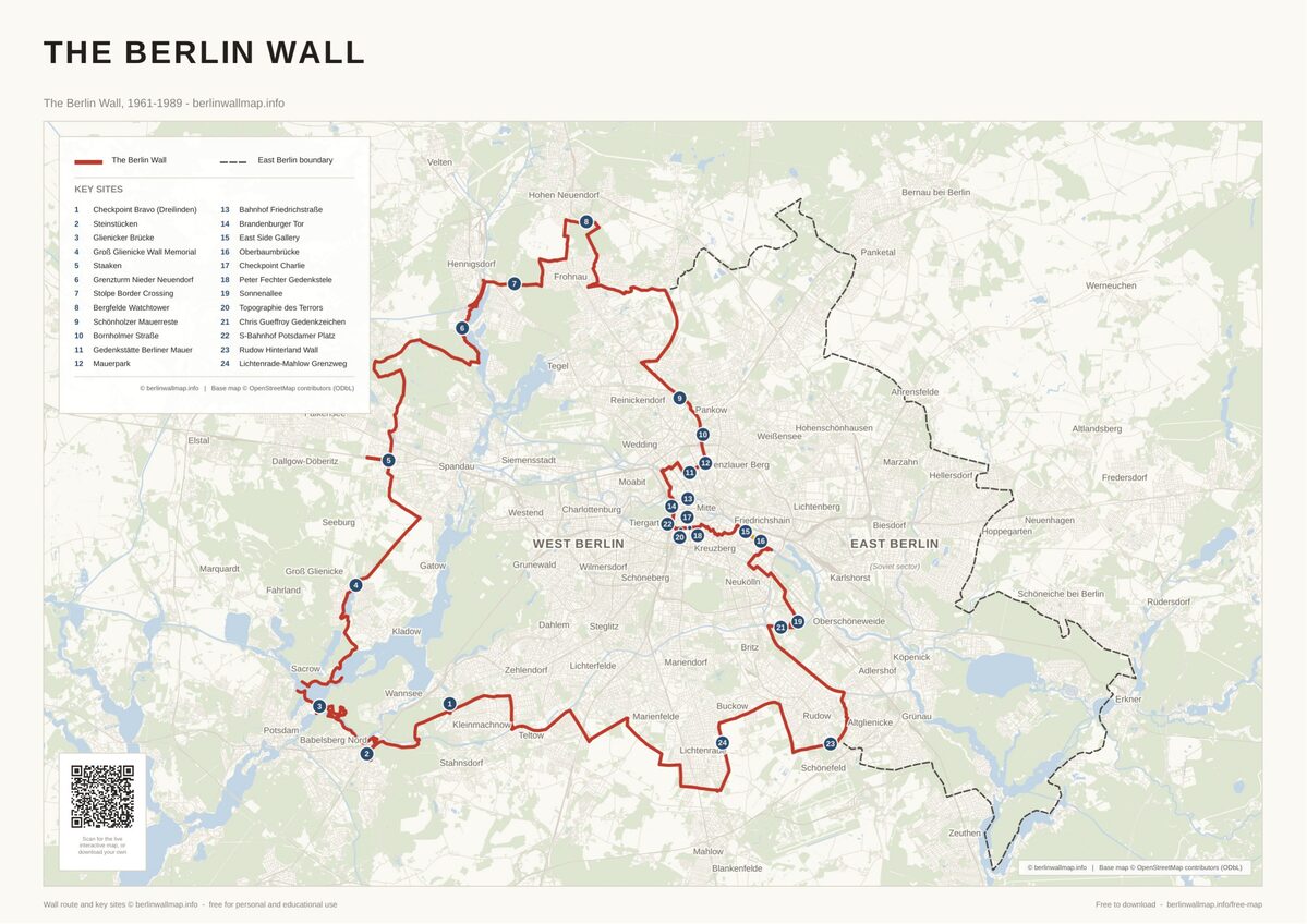
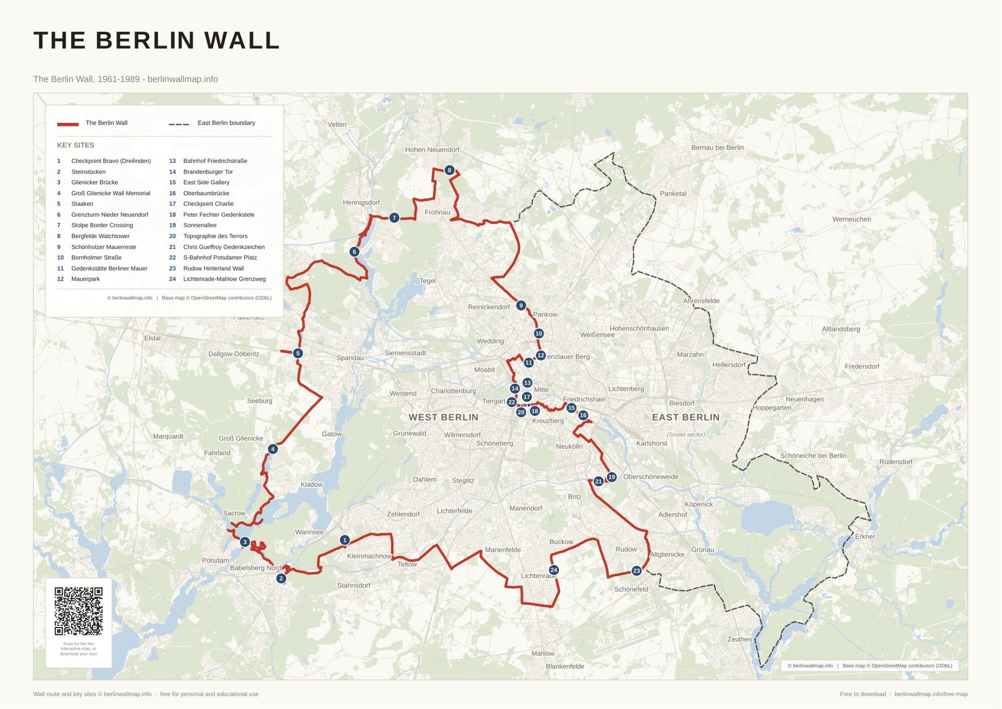
- The Wall's complete route around West Berlin (1961-1989) - about 155 km
- The border traced on a clear, present-day street map with districts, parks and water
- Checkpoint Charlie, the East Side Gallery and 24 key sites around the full loop
- Clean, print-ready A3 - ideal for classrooms and trip planning
Free for personal and educational use. Map (c) berlinwallmap.info; base wall route, death strip and sites by berlinwallmap.info. Please keep the attribution intact and do not resell.
Keep exploring
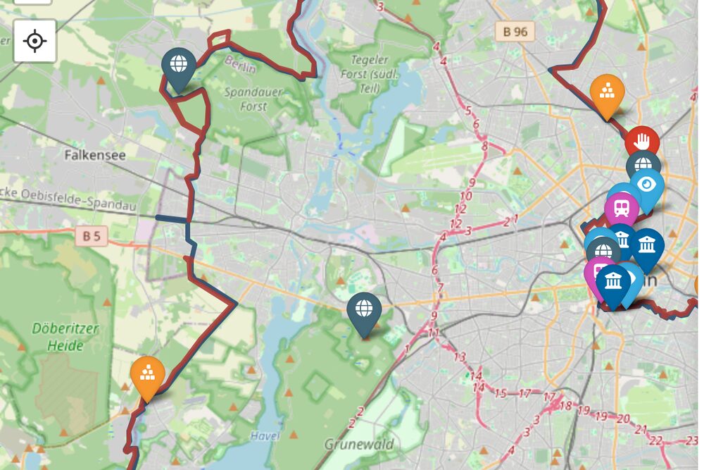 Explore the interactive map →
Search 80+ sites, memorials and crossings on a live, mobile-friendly map.
Explore the interactive map →
Search 80+ sites, memorials and crossings on a live, mobile-friendly map.
Walking map (PDF) Sectors map (PDF) Places to visit Guides & walks History timeline
Found this useful?
This map is free to download and share - and always will be. If it helped, you can support the project with a small tip. It keeps the maps free and the site going.
Support on Ko-fiFrequently asked questions
Is the Berlin Wall map really free to download?
Yes. The PDF is free for personal and educational use - download it, print it, share the link. We just ask that you keep the berlinwallmap.info attribution on the map.
What size is the PDF and can I print it at home?
It is laid out at A3 but prints cleanly down to A4 on a home printer. The file is a compact PDF of about 1 MB.
Does the map show the Wall on modern Berlin?
Yes. The route is drawn over a present-day street map, so you can match it to today's Berlin - handy for planning a walk or cycle along the former border.
Where did the Berlin Wall run?
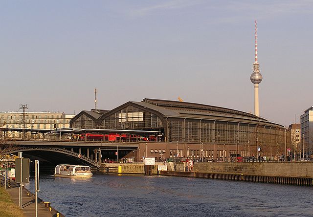
The Wall enclosed all of West Berlin - about 155 km - so it ran far beyond the city-centre line at Checkpoint Charlie and the Brandenburg Gate. This map shows the full route on a present-day street map, marking where it crossed each district and where sections survive today.

Free map downloads
Free printable PDF maps of the Berlin Wall.
Get the free maps →Explore the Timeline
Journey through Berlin Wall history from 1945 to 1990.
View Timeline →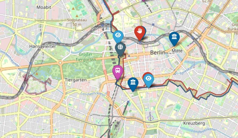
Embed Our Map
Add a free interactive Berlin Wall map to your website or blog.
Get embed code →