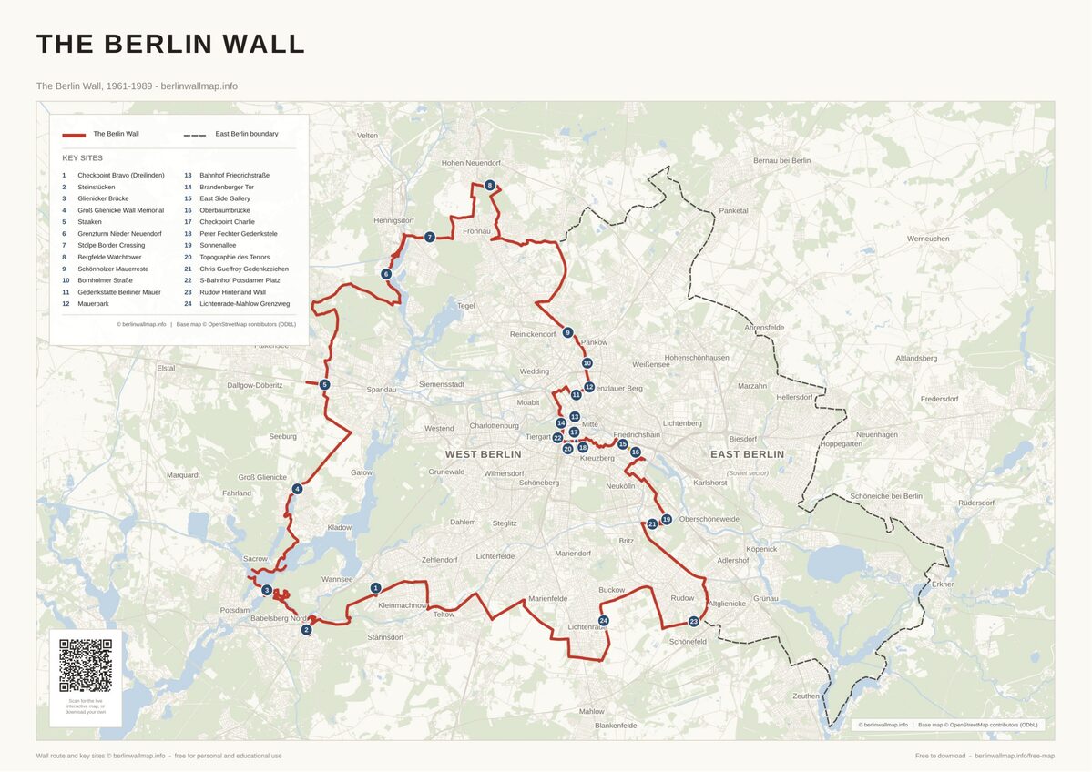
Berlin Wall Walking Map - Follow the Central Mauerweg (Free PDF)
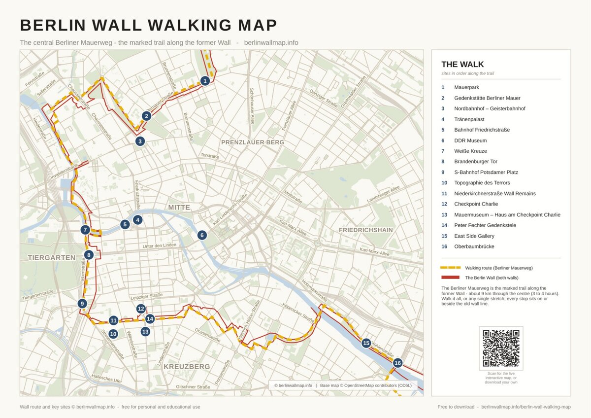
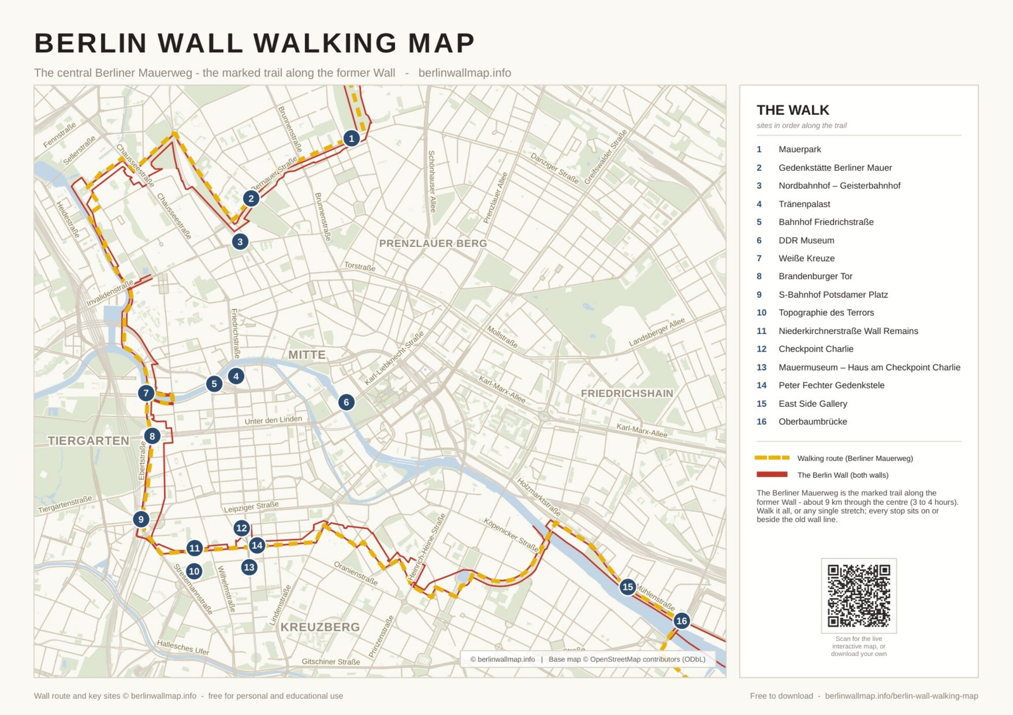
Download a free, printable map for walking the Berlin Wall through central Berlin. It follows the central stretch of the Berliner Mauerweg - the marked trail along the former Wall - past 16 key sites, from the memorial on Bernauer Strasse to Checkpoint Charlie and the East Side Gallery. About 9 km end to end, or walk any single stretch. Free for personal and educational use.
What's on the map
- The central stretch of the Berliner Mauerweg - the marked trail along the former Wall
- 16 key sites in order along the trail - from Bernauer Strasse to the East Side Gallery
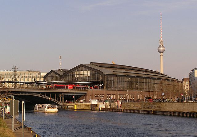
- Landmarks incl. the Brandenburg Gate, Checkpoint Charlie, Potsdamer Platz and the Nordbahnhof ghost station
- About 9 km end to end (3 to 4 hours) - or walk any single stretch
- Drawn on a clear, present-day street map with named streets - easy to follow on the ground
Free for personal and educational use. Map (c) berlinwallmap.info; wall route and sites by berlinwallmap.info; base map (c) OpenStreetMap contributors (ODbL). Please keep the attribution intact and do not resell.
Keep exploring
 Explore the interactive map →
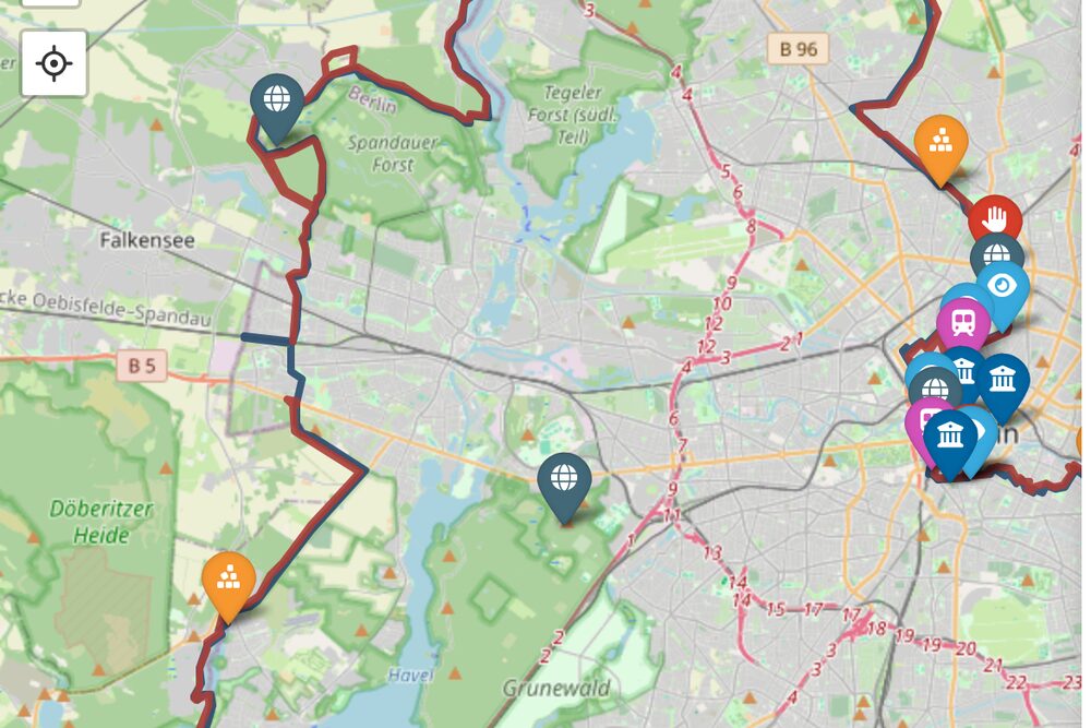
Search 80+ sites, memorials and crossings on a live, mobile-friendly map - handy for navigating on your phone as you walk.
Explore the interactive map →
Search 80+ sites, memorials and crossings on a live, mobile-friendly map - handy for navigating on your phone as you walk.
Guides & walks Places to visit Full route map (PDF) Sectors map (PDF)
Found this useful?
This map is free to download and share - and always will be. If it helped, you can support the project with a small tip. It keeps the maps free and the site going.
Support on Ko-fiFrequently asked questions
Is the Berlin Wall walking map free to download?
Yes. The PDF is free for personal and educational use - download it, print it, share the link. We only ask that you keep the berlinwallmap.info attribution on the map.
What is the Berliner Mauerweg?
It is the official signposted trail - about 160 km - that follows the entire former Wall around Berlin. This map covers its central stretch through the city centre, the most-visited section, linking 16 key sites.
How long is the central walk?
About 9 km end to end - allow 3 to 4 hours at a relaxed pace. Because it follows the marked trail along the former Wall, you can also walk any single stretch, such as Checkpoint Charlie to the East Side Gallery.
Where does the walk start and finish?
Roughly north to south: start at the Gedenkstaette Berliner Mauer on Bernauer Strasse (or Mauerpark) and finish at the East Side Gallery and the Oberbaumbruecke - or walk it in reverse. Every stop sits on or beside the former Wall.
Is there a map of the whole Berlin Wall?
Yes. This map covers the central core. For the complete route around West Berlin - about 155 km - download the full Berlin Wall overview map at berlinwallmap.info/free-map.


Free map downloads
Free printable PDF maps of the Berlin Wall.
Get the free maps →Explore the Timeline
Journey through Berlin Wall history from 1945 to 1990.
View Timeline →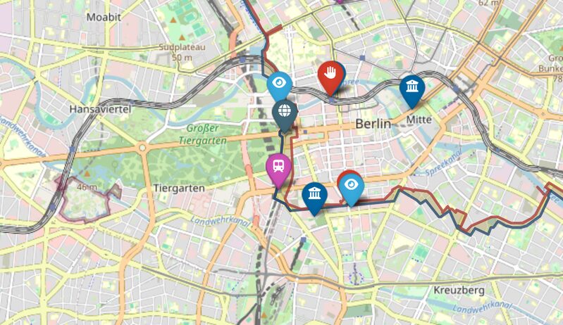
Embed Our Map
Add a free interactive Berlin Wall map to your website or blog.
Get embed code →